Merge Layers
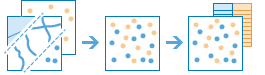
This tool combines two feature layers to create a single output layer. The layers to be merged must have the same geometry type and time type. You can control how the fields from the input layers are joined and copied. For example:
- I have three layers for England, Wales, and Scotland and I want a single layer of Great Britain.
- I have 2 layers and each contains parcel information for contiguous townships. I want to join them together into a single layer, keeping only the fields that have the same name and type on the 2 input layers.
Choose layer
The layer with tabular, point, line, or area features into which the second feature layer will merge. All fields from this layer will be included in the result layer.
Choose layer to merge
The feature layer to merge with the input layer. The layer to merge must have the same geometry type and time type as the input layer.
Modify merging fields
By default, all fields from both input layers will be included in the output. You can change how fields from the layer to merge will be included in the output with the following options:
- Rename—The field will be renamed in the output.
- Remove—The field will be removed from the output.
- Match—The field names are made equivalent. Values of the field from the layer to merge will be copied to the matched output field.
If both layers contain a field with an identical name and data type, the content of both fields will be merged into one field of that name. This does not apply to fields where Match is used in the Modify merging fields parameter.
Result layer name
Назва шару, який буде створено. Якщо ви записуєте результати у ArcGIS Data Store, вони будуть зберігатися у Мої ресурси і додаватися до карти. Якщо ви записуєте результати у спільне файлове сховище великих даних, вони будуть зберігатися у спільному файловому сховищі великих даних і додаватися до його маніфесту. Він не буде додаватися до карти. Назва за замовчуванням базується на назві інструменту та назві вхідного шару. Якщо шар уже існує, інструмент не буде працювати.
При записі до ArcGIS Data Store (реляційного або просторово-часового сховища великих даних) з використанням розкривного меню Зберегти результати в, можна указати ім’я папки у Мої ресурси, в яку будуть збережені результати.