Find Similar Locations
Based on criteria you specify, the Find Similar Locations tool measures the similarity of locations in your candidate search layer to one or more reference locations. This tool can answer questions such as
- Which of your stores are most similar to your top performers with regard to customer profiles?
- Based on characteristics of villages hardest hit by the disease, which other villages are high risk?
Choose layer containing the reference locations
The layer containing the reference locations to match.
Можна не тільки обирати шар на карті, а й обрати Вибрати шар аналізу внизу розкривного списку для огляду ваших ресурсів, які містяться у наборі даних спільного файлового сховища великих даних або у векторному шарі. Ви можете додатково застосувати фільтр на вашому вхідному шарі або застосувати вибір на розміщених на хості шарах, доданих до вашої карти. Фільтри та вибори застосовуються тільки для аналізу.
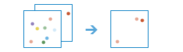
You may use all locations or make a selection
Use the selection buttons to identify the reference locations, if necessary. This option is only available if the features are drawn on the map (not available for a big data file share). For example, if the input layer contains all the locations—the reference locations as well as the candidate search locations—you will need to use one of the selection tools to identify the reference locations. If you create two separate layers, one with the reference locations and the other with all candidate search locations, you do not need to make a selection.
If there is more than one reference location, a single location is created by averaging the values for each of the fields used to analyze similarity.
Search for similar locations in
The candidate search features in this layer will be ranked from most to least similar.
Можна не тільки обирати шар на карті, а й обрати Вибрати шар аналізу внизу розкривного списку для огляду ваших ресурсів, які містяться у наборі даних спільного файлового сховища великих даних або у векторному шарі. Ви можете додатково застосувати фільтр на вашому вхідному шарі або застосувати вибір на розміщених на хості шарах, доданих до вашої карти. Фільтри та вибори застосовуються тільки для аналізу.
Base similarity on
The fields you select will be the criteria used to evaluate similarity. If you select a population and income field, for example, the candidate search locations with the lowest (best) rankings will be those that have similar population and income values to your reference locations.
Determine the most and least similar using
The method you select determines the how matching is determined.
- The field values method uses the squared differences of standardized values. This is the default.
- The field profiles method uses cosine similarity mathematics to compare the profile of standardized values. Using attribute profiles requires the use of at least two analysis fields.
Show me
You may either see all the candidate search locations ranked from most similar to least similar, or you can specify the number of results you would like to see.
- If you specify all locations from most to least similar, all the features in the candidate search layer will be included in rank order in the result layer. A maximum of 10,000 results will be returned.
- If you specify the
number ofmost, least, or most and leastsimilar locations, you determine how many of the most, least or most, and least similar candidates should be included in the result layer. The maximum allowed value is 10,000.
Choose fields to add to results
Optionally add fields to your data from your search layer. By default, all fields will be added.
Result layer name
Назва шару, який буде створено. Якщо ви записуєте результати у ArcGIS Data Store, вони будуть зберігатися у Мої ресурси і додаватися до карти. Якщо ви записуєте результати у спільне файлове сховище великих даних, вони будуть зберігатися у спільному файловому сховищі великих даних і додаватися до його маніфесту. Він не буде додаватися до карти. Назва за замовчуванням базується на назві інструменту та назві вхідного шару. Якщо шар уже існує, інструмент не буде працювати.
This result layer will contain the reference locations and the number of ranked candidate search features you specified. If the result layer name already exists, you will be asked to rename it.
При записі до ArcGIS Data Store (реляційного або просторово-часового сховища великих даних) з використанням розкривного меню Зберегти результати в, можна указати ім’я папки у Мої ресурси, в яку будуть збережені результати.