Watershed
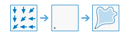
This tool determines the contributing area above a set of cells in a raster.
An input point on the Mississippi River in Louisiana will create a watershed feature extending to include areas from New York to Montana and into Canada.
Choose flow direction layer
The input raster that shows the direction of flow out of each cell.
The flow direction raster can be created using the Flow Direction raster function, with default flow direction type D8.
Specify input pour point locations
The input pour point locations.
This can be a raster or a point feature. For a raster, this represents cells above which the contributing area, or catchment, will be determined. All cells that are not NoData will be used as source cells. For a point input, this represents locations above which the contributing area, or catchment, will be determined.
Choose pour point field
The field used to assign values to the pour point locations.
If the input pour point layer is a raster, Value is used. If it is feature, a numeric field is used. If the field contains floating-point values, they will be truncated into integers.
Result layer name
The name of the layer that will be created in My Content and added to the map. The default name is based on the tool name and the input layer name. If the layer already exists, you will be prompted to provide another name.
You can specify the name of a folder in My Content where the result will be saved using the Save result in drop-down box. If you have the privileges to create both tiled and dynamic imagery layers, you can specify which layer type to generate in the output using the Save result as drop-down box.