Convert Raster To Feature
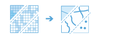
This tool converts a raster to a feature dataset as points, lines, or polygons.
The Choose field parameter allows you to choose which attribute field of the input raster dataset will become an attribute in the output feature class. This parameter is only available for integer rasters that have additional attributes in the associated table.
The input raster can have any cell size.
Integer rasters can be converted to point, line, or polygon features; however, floating-point rasters can only be converted to point features.
If Use current map extent is checked, only the raster cells that are visible within the current map extent will be converted. If unchecked, all cells in the raster layer will be converted, even if they are outside the current map extent. Take note of this if the raster layer is large or has a very high resolution.
Use cases for this tool include the following:
- Create polygon features from a land-use classification raster.
- Streams identified in a DEM can be converted to line features.
- A DEM can be converted to point features that can be used in a nonraster-based workflow.
Choose raster layer to convert
The input raster layer that will be converted to feature layers.
Choose field
A field that specifies the conversion value.
It can be any integer or text value.
A field containing floating-point values can only be used if the output is to a point dataset.
The default is the Value field, which contains the value in each raster cell.
Choose output type
Specifies the output type.
- Point—The raster will be converted to a point dataset. This is the default.
- Line—The raster will be converted to a line feature dataset.
- Polygon—The raster will be converted to a polygon feature dataset.
Simplify lines or polygons
Specifies whether lines or polygons will be simplified (smoothed). The smoothing is done in such a way that the line contains a minimum number of segments while remaining as close as possible to the original raster cell edges.
- Checked—The line or polygon features will be smoothed to produce a more generalized result. This is the default.
- Unchecked—The line or polygon features will follow the cell boundaries of the raster dataset.
This parameter is only supported if the output type is line or polygon.
Create multipart features
Specifies whether the output polygons will consist of single-part or multipart features.
- Checked—Multipart features will be created based on polygons that have the same value.
- Unchecked—Individual (single-part) features will be created for each polygon. This is the default.
This parameter is only supported if the output type is polygon.
Maximum vertices per polygon feature
The vertex limit used to subdivide a polygon into smaller polygons.
If left empty, the output polygons will not be split. This is the default.
This parameter is only supported if the output type is polygon.
Result layer name
The name of the layer that will be created in My Content and added to the map. The default name is based on the tool name and the input layer name. If the layer already exists, you will be prompted to provide another name.
You can specify the name of a folder in My Content where the result will be saved using the Save result in drop-down box.