Classify Objects Using Deep Learning
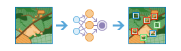
This tool runs a trained deep learning model on an input raster and an optional feature class to produce a feature class or table in which each input object has an assigned class label.
If Use current map extent is checked, only the raster area that is visible within the current map extent will be analyzed. If unchecked, the whole raster will be analyzed, even if it is outside the current map extent.
Choose image used to classify objects
The input image used to detect objects.
Choose feature layer for objects (Optional)
The point, line, or polygon input feature layer that identifies the location of each object to be classified and labelled. Each row in the input feature layer represents a single object.
If no input feature layer is specified, the tool assumes that each input image contains a single object to be classified. If the input image or images use a spatial reference, the output from the tool is a feature layer, in which the extent of each image is used as the bounding geometry for each labelled feature. If the input image or images are not spatially referenced, the output from the tool is a table containing the image ID values and the class labels for each image.
Choose deep learning model used to classify objects
The input deep learning package ( .dlpk) item.
The deep learning package is composed of the Esri model definition JSON file ( .emd), the deep learning binary model file, and optionally, the Python raster function to be used.
Processing Mode
Specifies how all raster items in a mosaic dataset or an image service will be processed. This parameter is applied when the input raster is a mosaic dataset or an image service.
- PROCESS_AS_MOSAICKED_IMAGE — All raster items in the mosaic dataset or image service will be mosaicked together and processed. This is the default.
- PROCESS_ITEMS_SEPARATELY — All raster items in the mosaic dataset or image service will be processed as separate images.
Specify deep learning model arguments
The function arguments are defined in the Python raster function class referenced by the input model. This is where you list additional deep learning parameters and arguments for experiments and refinement, such as a confidence threshold for adjusting the sensitivity.
The names of the arguments are populated by the tool from reading the Python module on the raster analysis server.
Define class label field name
The name of the field that will contain the classification label in the output feature layer.
If no field name is specified, a new field called ClassLabel will be generated in the output feature layer.
Process mode
Specifies how all raster items in an image service will be processed.
- Process as mosaicked image—All raster items in the image service will be mosaicked together and processed. This is the default.
- Process items separately—All raster items in the image service will be processed as separate images.
Result layer name
The name of the layer that will be created in My Content and added to the map. The default name is based on the tool name and the input layer name. If the layer already exists, you will be prompted to provide another name.
You can specify the name of a folder in My Content where the result will be saved using the Save result in drop-down box.