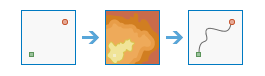
Determine Travel Cost Path As Polyline
Цей інструмент розраховує шлях полілінії з найменшою вартістю між місцями призначення та джерелами.
Example applications include the following:
- Find the best route for a new road in terms of construction costs.
- Identify the path to take from several suburban locations (sources) to the closest shopping mall (destination).
If Use current map extent is checked, only those locations in the input layers that are visible within the current map extent will be analyzed. If unchecked, all locations in both input layers will be analyzed, even if they are outside the current map extent.
Choose raster or feature source layer to determine paths from
An image service or feature service that identifies the cells from which the least-cost path is determined to the least costly destination.
If the input is an image service, the input consists of cells that have valid values (zero is a valid value), and the remaining cells must be assigned NoData.
Choose travel cost raster layer
Растр, який визначає імпеданс або вартість руху в площині через кожний осередок.
Значення в кожному місці розташування осередку представляє вартість руху через осередок, виражену на одиницю відстані. Для отримання загальної вартості проходження через осередок, значення кожного осередку множиться на роздільну здатність осередку з урахуванням можливості руху по діагоналі.
Значення на растрі вартості можуть бути представлені цілими числами або числами з плаваючою точкою, але вони не можуть бути від’ємними або нульовими (вартість не може бути від’ємною або нульовою).
Input Destination Raster or Features
An input that defines the destinations used to calculate the distance. The layer can be raster or feature.
If the input is an image service, the input consists of cells that have valid values (zero is a valid value), and the remaining cells must be assigned NoData.
Result polyline layer name
Назва шару, який буде створено в Мої ресурси і додано до карти. Ім'я за замовчуванням визначається на основі імені інструменту та імені вхідного шару. Якщо шар уже існує, вам буде запропоновано вказати іншу назву.
Використовуючи розкривний список Зберегти результат у, можна вказати ім'я папки в Мій вміст, де зберігатиметься результат. Якщо у вас є права на створення як шарів зображень з тайлами, так і динамічних шарів зображень, ви можете вказати, який тип шару необхідно згенерувати для виводу, використовуючи розкривне меню Зберегти результат як
Choose type of paths to determine
Defines the manner in which the values and zones on the input destination data will be interpreted in the cost path calculations.
- Best Single—For all cells or locations on the input destination data, the least-cost path is derived from the location with the minimum of the least-cost paths to source location. This is the default
- To Each Cell—For each cell or location with valid values on the input destination data, a least-cost path is determined and saved on the output feature service. With this option, each cell of the input destination data is treated separately, and a least-cost path is determined for each from cell.
- To Each Zone—For each zone on the input destination data, a least-cost path is determined and saved on the output feature service. With this option, the least-cost path for each zone begins at the cell or location with the lowest cost distance weighting in the zone.
Choose field to obtain values for destination
The field used to obtain values for the destination locations.