Predict Using Trend Raster
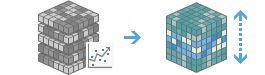
Computes a forecasted multidimensional raster using the output trend raster from the Generate Trend Raster tool.
If Use current map extent is checked, variables of the layer that are visible within the current map extent will be analyzed. If unchecked, variables of the full layer will be analyzed, even if they are outside the current map extent.
Choose multidimensional imagery layer to predict
The input multidimensional trend raster from the Generate Trend Raster tool.
Choose variable(s) that will be predicted
The variable or variables that will be predicted in the analysis. If no variables are specified, all variables will be used.
Choose the method used to provide prediction dimension values
Specifies the method used to provide prediction dimension values.
- By Value—The prediction will be calculated for a single dimension value or a list of dimension values specified in the next step. This is the default. For example, you want to predict yearly precipitation for the years 2050, 2100, and 2150.
- By Interval—The prediction will be calculated for an interval of the dimension defined by a start and an end value. For example, you want to predict yearly precipitation for every year between 2050 and 2150.
Specify dimension value(s) for prediction
The dimension value or values to be used in the prediction.
The format of the time, depth, and height values must match the format of the dimension values used to generate the trend raster. If the trend raster was generated for the StdTime dimension, the format should be YYYY-MM-DDTHH:MM:SS, for example 2050-01-01T00:00:00. Multiple values are separated with a semicolon.
This parameter is required when the By value method is selected to define dimension values for prediction.
Start
The start date, height, or depth of the dimension interval to be used in the prediction.
End
The end date, height, or depth of the dimension interval to be used in the prediction.
Define the dimension interval for prediction
Define the start and end date, height, or depth of the dimension interval to be used in the prediction.
Specify the number of steps between the start and end values
The number of steps between two dimension values to be included in the prediction. The default value is 1.
For example, to predict temperature values every five years, use a value of 5.
Choose the unit that will be used for the time value interval
Specifies the unit that will be used for the value interval. This only applies when the dimension of analysis is a time dimension.
Result layer name
The name of the layer that will be created in My Content and added to the map. The default name is based on the tool name and the input layer name. If the layer already exists, you will be prompted to provide another name.
You can specify the name of a folder in My Content where the result will be saved using the Save result in drop-down box. If you have the privileges to create both tiled and dynamic imagery layers, you can specify which layer type to generate in the output using the Save result as drop-down box.